xdem.volume
Volume change calculation tools (aimed for glaciers).
Contents
Functions
calculate_hypsometry_area
- xdem.volume.calculate_hypsometry_area(ddem_bins, ref_dem, pixel_size, timeframe='reference')[source]
Calculate the associated representative area of the given dDEM bins.
By default, the area bins will be representative of the mean timing between the reference and nonreference DEM: elevations = ref_dem - (h_vs_dh_funcion(ref_dem) / 2) This can be changed to either “reference”: elevations = ref_dem Or “nonreference”: elevations = ref_dem - h_vs_dh_function(ref_dem)
- Parameters
ddem_bins – A Series or DataFrame of dDEM values. If a DataFrame is given, the column ‘value’ will be used.
ref_dem – The reference DEM. This should not have any NaNs.
pixel_size – The xy or (x, y) size of the reference DEM pixels in georeferenced coordinates.
timeframe – The time at which the area bins are representative. Choices: “reference”, “nonreference”, “mean”
- Returns
The representative area within the given dDEM bins.
fit_hypsometric_bins_poly
- xdem.volume.fit_hypsometric_bins_poly(hypsometric_bins, value_column='value', degree=3, iterations=1, count_threshold=None)[source]
Fit a polynomial to the hypsometric bins.
- Parameters
hypsometric_bins (
DataFrame) – Bins where nans will be interpolated.value_column (
str) – The name of the column in ‘hypsometric_bins’ to use as values.degree (
int) – The degree of the polynomial to use.iterations (
int) – The number of iterations to run. At each iteration, values with residuals larger than 3 times the residuals’ standard deviation are excluded.count_threshold (
Optional[int]) – Optional. A pixel count threshold to exclude during the curve fit (requires a ‘count’ column).
- Return type
Series- Returns
Bins replaced by the polynomial fit.
get_regional_hypsometric_signal
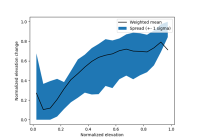
- xdem.volume.get_regional_hypsometric_signal(ddem, ref_dem, glacier_index_map, n_bins=20, verbose=False, min_coverage=0.05)[source]
Get the normalized regional hypsometric elevation change signal, read “the general shape of it”.
- Parameters
n_bins = 20 # TODO: This should be an argument. :type n_bins:
int:param n_bins: The number of elevation bins to subdivide each glacier in.- Return type
DataFrame- Returns
A DataFrame of bin statistics, scaled by elevation and elevation change.
hypsometric_binning
- xdem.volume.hypsometric_binning(ddem, ref_dem, bins=50.0, kind='fixed', aggregation_function=<function median>)[source]
Separate the dDEM in discrete elevation bins. The elevation bins will be calculated based on all ref_dem valid pixels. ddem may contain NaN/masked values over the same area, they will be excluded before the aggregation.
It is assumed that the dDEM is calculated as ‘ref_dem - dem’ (not ‘dem - ref_dem’).
- Parameters
ddem (
ndarray) – The dDEM as a 2D or 1D array.ref_dem (
ndarray) – The reference DEM as a 2D or 1D array.bins (
Union[float,ndarray]) – The bin size, count, or array, depending on the binning method (‘kind’).kind (
str) – The kind of binning to do. Choices: [‘fixed’, ‘count’, ‘quantile’, ‘custom’].aggregation_function (
Callable) – The function to aggregate the elevation values within a bin. Defaults to the median.
- Return type
DataFrame- Returns
A Pandas DataFrame with elevation bins and dDEM statistics.
hypsometric_interpolation
- xdem.volume.hypsometric_interpolation(voided_ddem, ref_dem, mask)[source]
Interpolate a dDEM using hypsometric interpolation within the given mask.
Using ref_dem, elevation bins of constant height (hard-coded to 50 m for now) are created. Gaps in voided-ddem, within the provided mask, are filled with the median dDEM value within that bin.
- Parameters
voided_ddem (
Union[ndarray,MaskedArray]) – A dDEM with voids (either an array with nans or a masked array).ref_dem (
Union[ndarray,MaskedArray]) – The reference DEM in the dDEM comparison.mask (
ndarray) – A mask to delineate the area that will be interpolated (True means hypsometric will be used).
- Return type
MaskedArray
interpolate_hypsometric_bins
- xdem.volume.interpolate_hypsometric_bins(hypsometric_bins, value_column='value', method='polynomial', order=3, count_threshold=None)[source]
Interpolate hypsometric bins using any valid Pandas interpolation technique.
NOTE: It will not extrapolate!
- Parameters
hypsometric_bins (
DataFrame) – Bins where nans will be interpolated.value_column – The name of the column in ‘hypsometric_bins’ to use as values.
method – Any valid Pandas interpolation technique (e.g. ‘linear’, ‘polynomial’, ‘ffill’, ‘bfill’).
order – The polynomial order to use. Only used if method=’polynomial’.
count_threshold (
Optional[int]) – Optional. A pixel count threshold to exclude during the curve fit (requires a ‘count’ column).
- Return type
DataFrame- Returns
Bins interpolated with the chosen interpolation method.
linear_interpolation
- xdem.volume.linear_interpolation(array, max_search_distance=10, extrapolate=False, force_fill=False)[source]
Interpolate a 2D array using rasterio’s fillnodata.
- Parameters
array (
Union[ndarray,MaskedArray]) – An array with NaNs or a masked array to interpolate.max_search_distance (
int) – The maximum number of pixels to search in all directions to find values to interpolate from. The default is 10.extrapolate (
bool) – if False, will remove pixels that have been extrapolated by fillnodata. Default is False.force_fill (
bool) – if True, will replace all remaining gaps by the median of all valid values. Default is False.
- Return type
- Returns
A filled array with no NaNs
local_hypsometric_interpolation
- xdem.volume.local_hypsometric_interpolation(voided_ddem, ref_dem, mask, min_coverage=0.2, count_threshold=1, nodata=- 9999, plot=False)[source]
Interpolate a dDEM using local hypsometric interpolation. The algorithm loops through each features in the vector file.
The dDEM is assumed to have been created as “voided_ddem = reference_dem - other_dem”.
- Parameters
voided_ddem (
Union[ndarray,MaskedArray]) – A dDEM with voids (either an array with nans or a masked array).ref_dem (
Union[ndarray,MaskedArray]) – The reference DEM in the dDEM comparison.mask (
ndarray) – A raster of same shape as voided_ddem and ref_dem, containing a diferent non-0 pixel value for each geometry on which to loop.min_coverage (
float) – Optional. The minimum coverage fraction to be considered for interpolation.count_threshold (
Optional[int]) – Optional. A pixel count threshold to exclude during the hypsometric curve fit.nodata (
Union[float,int]) – Optional. No data value to be used for the output masked_array.plot (
bool) – Set to True to display intermediate plots.
- Return type
MaskedArray- Returns
A dDEM with gaps filled by applying a hypsometric interpolation for each geometry in mask, for areas filling the min_coverage criterion.
norm_regional_hypsometric_interpolation
- xdem.volume.norm_regional_hypsometric_interpolation(voided_ddem, ref_dem, glacier_index_map, min_coverage=0.1, regional_signal=None, verbose=False, min_elevation_range=0.33, idealized_ddem=False)[source]
Interpolate missing values by scaling the normalized regional hypsometric signal to each glacier separately.
Only missing values are interpolated. The rest of the glacier’s values are fixed.
- Parameters
voided_ddem (
Union[ndarray,MaskedArray]) – The voided dDEM to fill NaNs in.ref_dem (
Union[ndarray,MaskedArray]) – A void-free reference DEM.glacier_index_map (
ndarray) – An array glacier indices of the same shape as the previous inputs.min_coverage (
float) – The minimum fractional coverage of a glacier to interpolate. Defaults to 10%.regional_signal (
Optional[DataFrame]) – A regional signal is already estimate. Otherwise one will be estimated.verbose (
bool) – Show progress bars.min_elevation_range (
float) – The minimum allowed min/max bin range to scale a signal from. Default: 1/3 of the elevation range needs to be present.idealized_ddem (
bool) – Replace observed glacier values with the hypsometric signal. Good for error assessments.
- Raises
AssertionError – If ref_dem has voids.
- Return type
- Returns
A dDEM where glacier’s that fit the min_coverage criterion are interpolated.